[/caption]
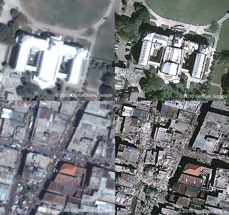
The folks at Google Earth and the satellite imaging company GeoEye have teamed up to make available the most recent Haiti photos -- taken at approximately 10:27am EST on January 13, 2010. It is available as a KML overlay for Google Earth, and you can
download the KML here
and open it in Google Earth. You can also open the file in Google Maps. As you'll see, the imagery shows a powerful glimpse into the destruction in Haiti. Above are before-and-after screenshots of the Presidential Palace and an area of Port-au-Prince.
Google said they will continue to automatically update the layer (you'll only need to download it once) to make more imagery and data available.
If you don't have
Google Earth
(what!) you can
go to this page
and see the images in an embedded KML viewer.
Google also has a listing of how you can help the relief efforts in Haiti.
Source:
Google Lat Long Blog